Technical brief
Full specification and field notes.
# Hi-Target V30 Plus GNSS RTK System
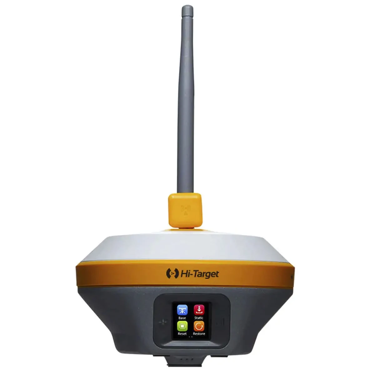
The **Hi-Target V30 Plus GNSS RTK System** is a high-precision GNSS receiver designed for professional land surveying, topographic mapping, construction layout, and infrastructure projects. Combining 1408 GNSS channels, multi-constellation satellite tracking, tilt compensation, and rugged IP67 protection, the V30 Plus delivers reliable positioning performance for demanding field applications.
Whether you are carrying out a topographic survey, setting out construction points, or collecting accurate coordinates for engineering projects, the V30 Plus provides a practical and efficient GNSS RTK solution.
## Key Features
### High-Precision GNSS Positioning
The V30 Plus supports **1408 GNSS channels** and multiple satellite constellations, including GPS, GLONASS, BeiDou, Galileo, QZSS, SBAS, and IRNSS. This multi-constellation capability helps improve satellite availability and positioning reliability in challenging surveying environments.
The receiver delivers RTK positioning accuracy of **8 mm + 1 ppm RMS horizontally** and **15 mm + 1 ppm RMS vertically**, making it suitable for professional surveying and construction applications.
### Tilt Compensation for Faster Fieldwork
The V30 Plus features tilt compensation with a specified accuracy of **8 mm + 0.7 mm/°**. This allows surveyors to collect points without keeping the survey pole perfectly vertical, improving efficiency when working around obstacles, on uneven terrain, or in difficult-to-access locations.
### Flexible Communication Options
With **Bluetooth, Wi-Fi, 4G, and UHF radio** connectivity, the V30 Plus supports flexible communication and data transfer for different field workflows. These options make it suitable for GNSS RTK surveying using compatible correction services and radio-based configurations.
### Rugged Design for Demanding Conditions
Built for professional outdoor use, the V30 Plus features **IP67-rated dust and water protection** and is designed to withstand a **2-meter drop onto concrete**. Its compact construction and operating temperature range of **-45°C to +75°C** make it suitable for demanding surveying environments.
### Long Battery Life
The receiver provides **up to 10 hours of operation in RTK rover mode**, helping surveying teams complete extended field sessions with fewer interruptions.
## Technical Specifications
| Specification | Details |
| ---------------------------- | ------------------------------------------------ |
| **Model** | Hi-Target V30 Plus |
| **Product Type** | GNSS RTK Receiver |
| **GNSS Channels** | 1408 channels |
| **Supported Constellations** | GPS, GLONASS, BeiDou, Galileo, QZSS, SBAS, IRNSS |
| **RTK Horizontal Accuracy** | 8 mm + 1 ppm RMS |
| **RTK Vertical Accuracy** | 15 mm + 1 ppm RMS |
| **Tilt Accuracy** | 8 mm + 0.7 mm/° |
| **Battery Life** | Up to 10 hours (RTK rover mode) |
| **Protection Rating** | IP67 |
| **Drop Resistance** | 2 meters onto concrete |
| **Connectivity** | Bluetooth, Wi-Fi, 4G, UHF radio |
| **Dimensions** | 164 mm × 83.5 mm |
| **Weight** | ≤1.4 kg, including battery |
| **Operating Temperature** | -45°C to +75°C |
## Applications
The **Hi-Target V30 Plus GNSS RTK** is suitable for a wide range of professional applications, including land surveying and topographic mapping, construction staking and site layout, road and infrastructure projects, utility mapping, agricultural surveying, and mining-related field measurements.
Its combination of precise positioning, tilt compensation, and durable construction makes it a dependable choice for surveyors and engineering teams who require efficient data collection in the field.
## Accessories and Package Options
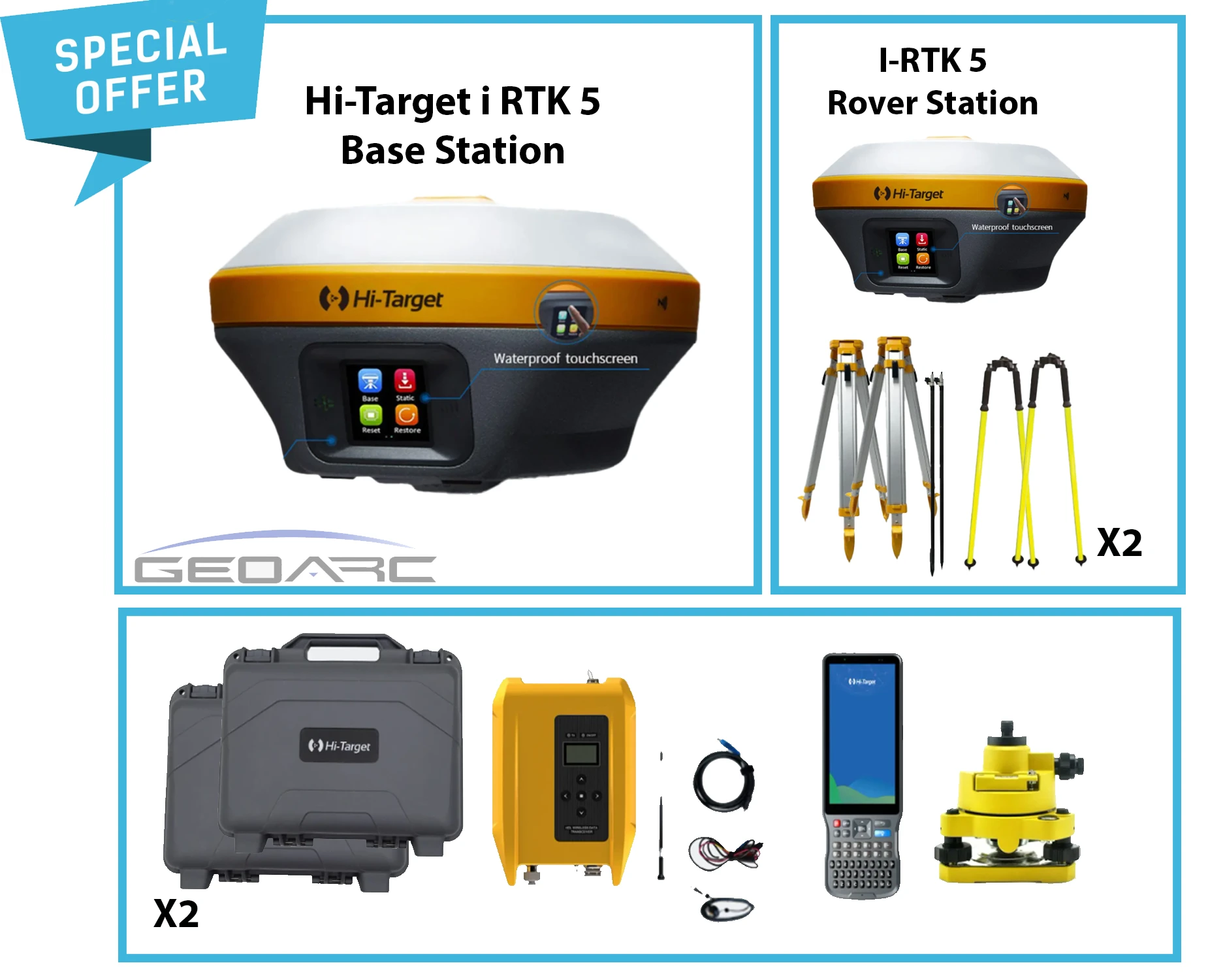
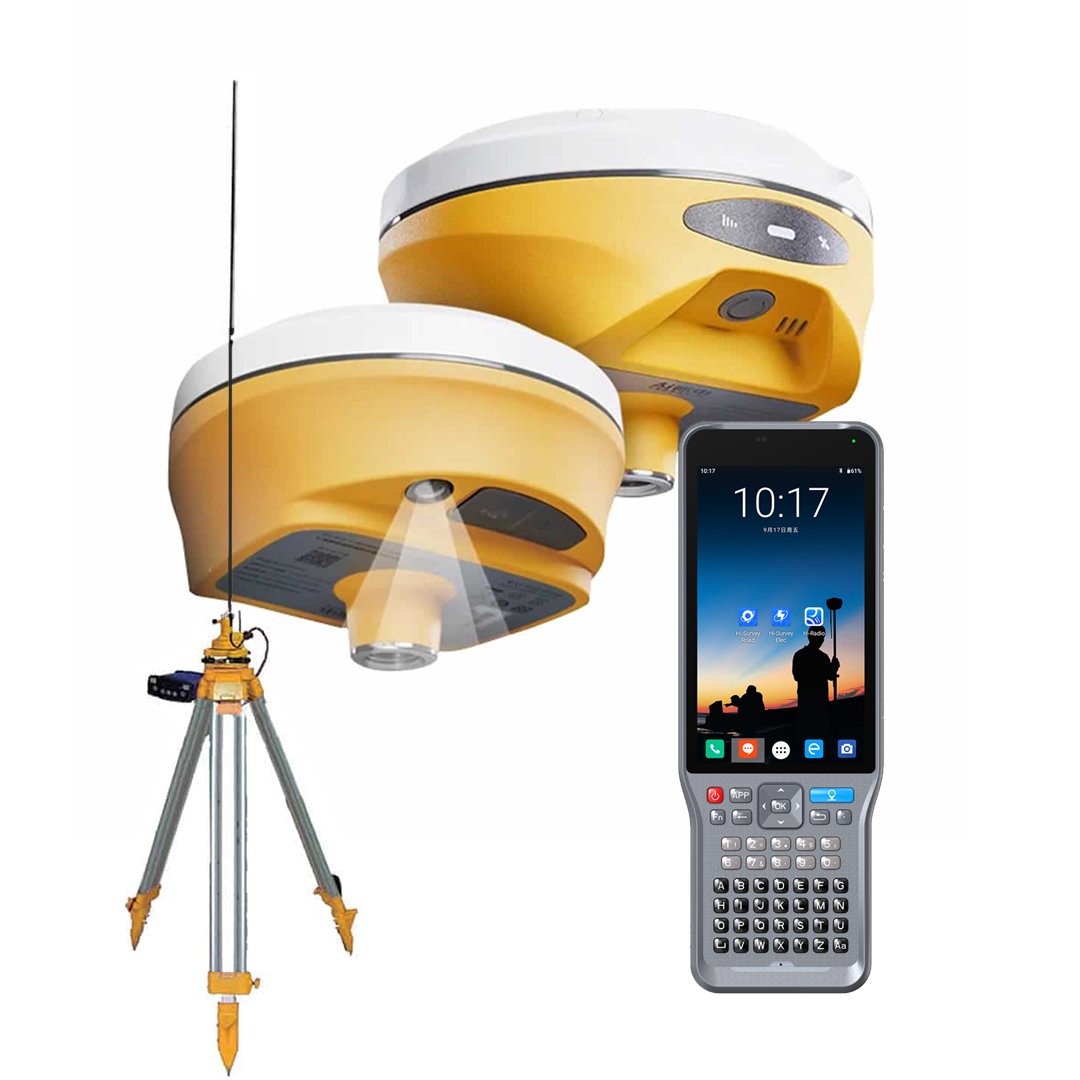
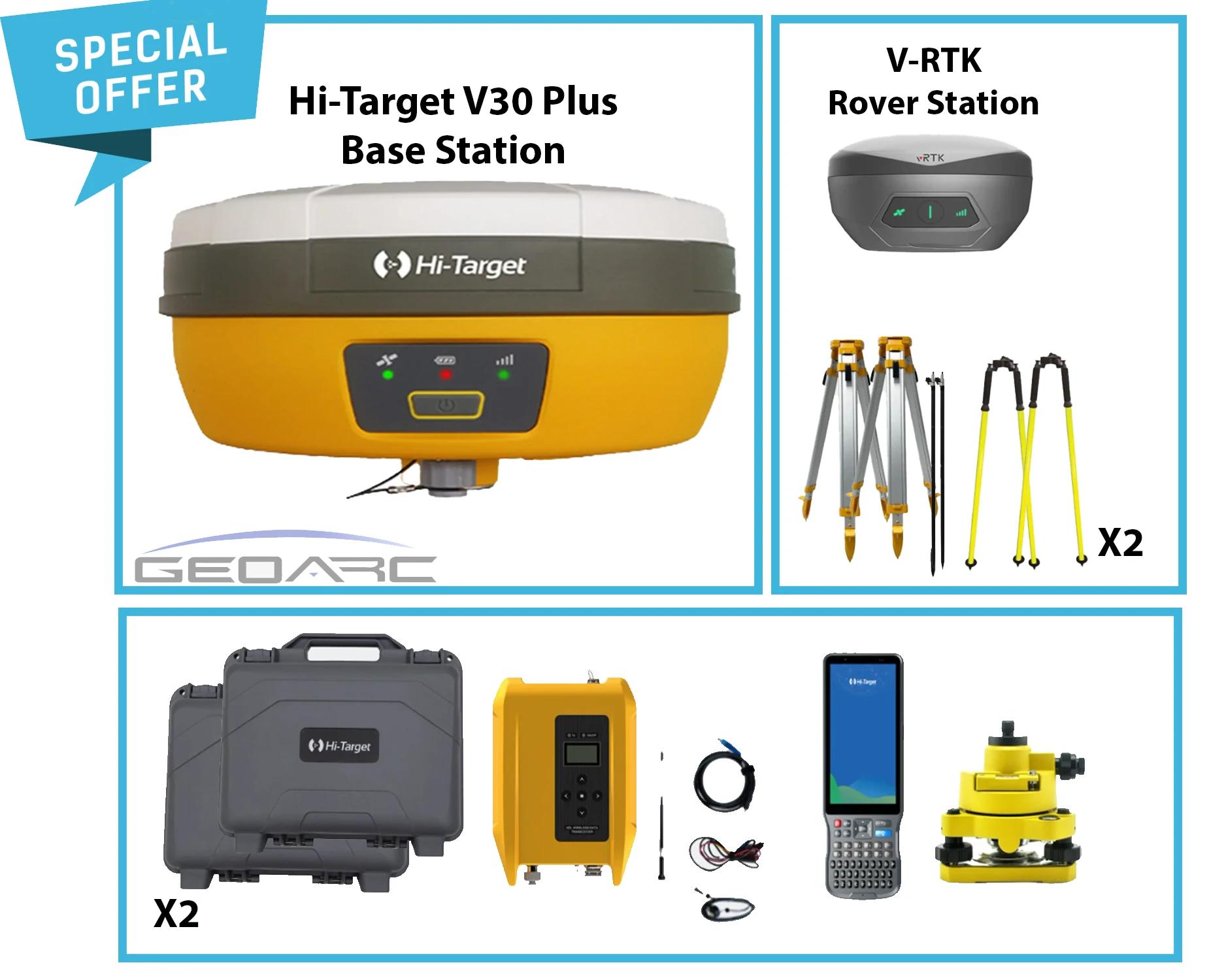
The V30 Plus can be supplied with compatible surveying accessories depending on the selected package and project requirements. Available configurations may include a GNSS receiver, controller, surveying software, batteries, charger, carrying case, mounting accessories, survey pole, tripod, and external UHF radio.
**Package contents should be confirmed in the official quotation**, as accessories and configurations may vary.
## Why Choose the Hi-Target V30 Plus?
The V30 Plus combines **high-precision RTK positioning, 1408-channel GNSS tracking, tilt compensation, flexible connectivity, and rugged field durability** in one professional surveying receiver. It is an excellent solution for teams looking to improve productivity while maintaining reliable positioning accuracy across surveying and construction projects.
**Contact GeoArc for availability, package options, technical information, and an official quotation for the Hi-Target V30 Plus GNSS RTK System.**
The **Hi-Target V30 Plus GNSS RTK System** is a high-precision GNSS receiver designed for professional land surveying, topographic mapping, construction layout, and infrastructure projects. Combining 1408 GNSS channels, multi-constellation satellite tracking, tilt compensation, and rugged IP67 protection, the V30 Plus delivers reliable positioning performance for demanding field applications.
Whether you are carrying out a topographic survey, setting out construction points, or collecting accurate coordinates for engineering projects, the V30 Plus provides a practical and efficient GNSS RTK solution.
## Key Features
### High-Precision GNSS Positioning
The V30 Plus supports **1408 GNSS channels** and multiple satellite constellations, including GPS, GLONASS, BeiDou, Galileo, QZSS, SBAS, and IRNSS. This multi-constellation capability helps improve satellite availability and positioning reliability in challenging surveying environments.
The receiver delivers RTK positioning accuracy of **8 mm + 1 ppm RMS horizontally** and **15 mm + 1 ppm RMS vertically**, making it suitable for professional surveying and construction applications.
### Tilt Compensation for Faster Fieldwork
The V30 Plus features tilt compensation with a specified accuracy of **8 mm + 0.7 mm/°**. This allows surveyors to collect points without keeping the survey pole perfectly vertical, improving efficiency when working around obstacles, on uneven terrain, or in difficult-to-access locations.
### Flexible Communication Options
With **Bluetooth, Wi-Fi, 4G, and UHF radio** connectivity, the V30 Plus supports flexible communication and data transfer for different field workflows. These options make it suitable for GNSS RTK surveying using compatible correction services and radio-based configurations.
### Rugged Design for Demanding Conditions
Built for professional outdoor use, the V30 Plus features **IP67-rated dust and water protection** and is designed to withstand a **2-meter drop onto concrete**. Its compact construction and operating temperature range of **-45°C to +75°C** make it suitable for demanding surveying environments.
### Long Battery Life
The receiver provides **up to 10 hours of operation in RTK rover mode**, helping surveying teams complete extended field sessions with fewer interruptions.
## Technical Specifications
| Specification | Details |
| ---------------------------- | ------------------------------------------------ |
| **Model** | Hi-Target V30 Plus |
| **Product Type** | GNSS RTK Receiver |
| **GNSS Channels** | 1408 channels |
| **Supported Constellations** | GPS, GLONASS, BeiDou, Galileo, QZSS, SBAS, IRNSS |
| **RTK Horizontal Accuracy** | 8 mm + 1 ppm RMS |
| **RTK Vertical Accuracy** | 15 mm + 1 ppm RMS |
| **Tilt Accuracy** | 8 mm + 0.7 mm/° |
| **Battery Life** | Up to 10 hours (RTK rover mode) |
| **Protection Rating** | IP67 |
| **Drop Resistance** | 2 meters onto concrete |
| **Connectivity** | Bluetooth, Wi-Fi, 4G, UHF radio |
| **Dimensions** | 164 mm × 83.5 mm |
| **Weight** | ≤1.4 kg, including battery |
| **Operating Temperature** | -45°C to +75°C |
## Applications
The **Hi-Target V30 Plus GNSS RTK** is suitable for a wide range of professional applications, including land surveying and topographic mapping, construction staking and site layout, road and infrastructure projects, utility mapping, agricultural surveying, and mining-related field measurements.
Its combination of precise positioning, tilt compensation, and durable construction makes it a dependable choice for surveyors and engineering teams who require efficient data collection in the field.
## Accessories and Package Options
The V30 Plus can be supplied with compatible surveying accessories depending on the selected package and project requirements. Available configurations may include a GNSS receiver, controller, surveying software, batteries, charger, carrying case, mounting accessories, survey pole, tripod, and external UHF radio.
**Package contents should be confirmed in the official quotation**, as accessories and configurations may vary.
## Why Choose the Hi-Target V30 Plus?
The V30 Plus combines **high-precision RTK positioning, 1408-channel GNSS tracking, tilt compensation, flexible connectivity, and rugged field durability** in one professional surveying receiver. It is an excellent solution for teams looking to improve productivity while maintaining reliable positioning accuracy across surveying and construction projects.
**Contact GeoArc for availability, package options, technical information, and an official quotation for the Hi-Target V30 Plus GNSS RTK System.**
Project quote
Tell us the emirate and quantity.
GeoArc replies with a local package: instrument, training and delivery.
Field notes
Reviews from survey crews
Be the first crew to leave a field note.